
 .................................................................................................................................................


Region VI – Northwest Pontic
Geography
Other than the temperate zones of the Balkans, the Pontic region is characterised by an arid climate. The coastal steppe (VIa) and the forest steppe (VIb) are cut by large rivers, notably the Southern Bug and the Dniestr (name givers for the Bug-Dniestr culture) that are directly flowing into the Black Sea (Figure 1). They represent the northeastern limit of the study area. On the other hand, the Prut and Siret Rivers, together with the Buzău and Ialomiţa are not only part of the Danube catchment but also of the steppe vegetation that connects Region VI with the steppe area of the eastern Lower Danube (Subregion IVd).

Figure 1. Map of eastern Balkans and the northwest and west Pontic region
Sites (n=40)
| VIa: NW Pontic-coastal steppe | VIb: NW Pontic-forest steppe |
| Cheia | Baz'kov Ostrov |
| Gard | Căinari |
| Gard 3 | Dobryanka 1 |
| Ghirzhove | Dobryanka 3 |
| Giurgiuleşti | Erbiceni |
| Hamangia-Baia Goloviţa | Mit'kovostrov |
| Isaccea-Suhat | Pechera |
| Košary I | Poduri-Dealul Ghindaru (Bacău) |
| Luncaviţa | Poiana Slatinei |
| Mikolina Broyarka | Rogojani I |
| Myrne | Ruseştii Noi I |
| Pugach 2 | Sacarovca |
| Savran | Selişte I |
| Taraschina | Sokoltsi 1 |
| Vulcăneşti II | Sokoltsi 2 |
| Soroca II-Trifăuţi | |
| Soroca III | |
| Soroca V | |
| Târgu Frumos | |
| Târpești | |
| Tătărăuca Nouă XIV | |
| Tătărăuca Nouă XV | |
| Timkovo | |
| Trestiana | |
| Zan'kovtsi |
Geography
Other than the temperate zones of the Balkans, the Pontic region is characterised by an arid climate. The coastal steppe (VIa) and the forest steppe (VIb) are cut by large rivers, notably the Southern Bug and the Dniestr (name givers for the Bug-Dniestr culture) that are directly flowing into the Black Sea (Figure 1). They represent the northeastern limit of the study area. On the other hand, the Prut and Siret Rivers, together with the Buzău and Ialomiţa are not only part of the Danube catchment but also of the steppe vegetation that connects Region VI with the steppe area of the eastern Lower Danube (Subregion IVd).
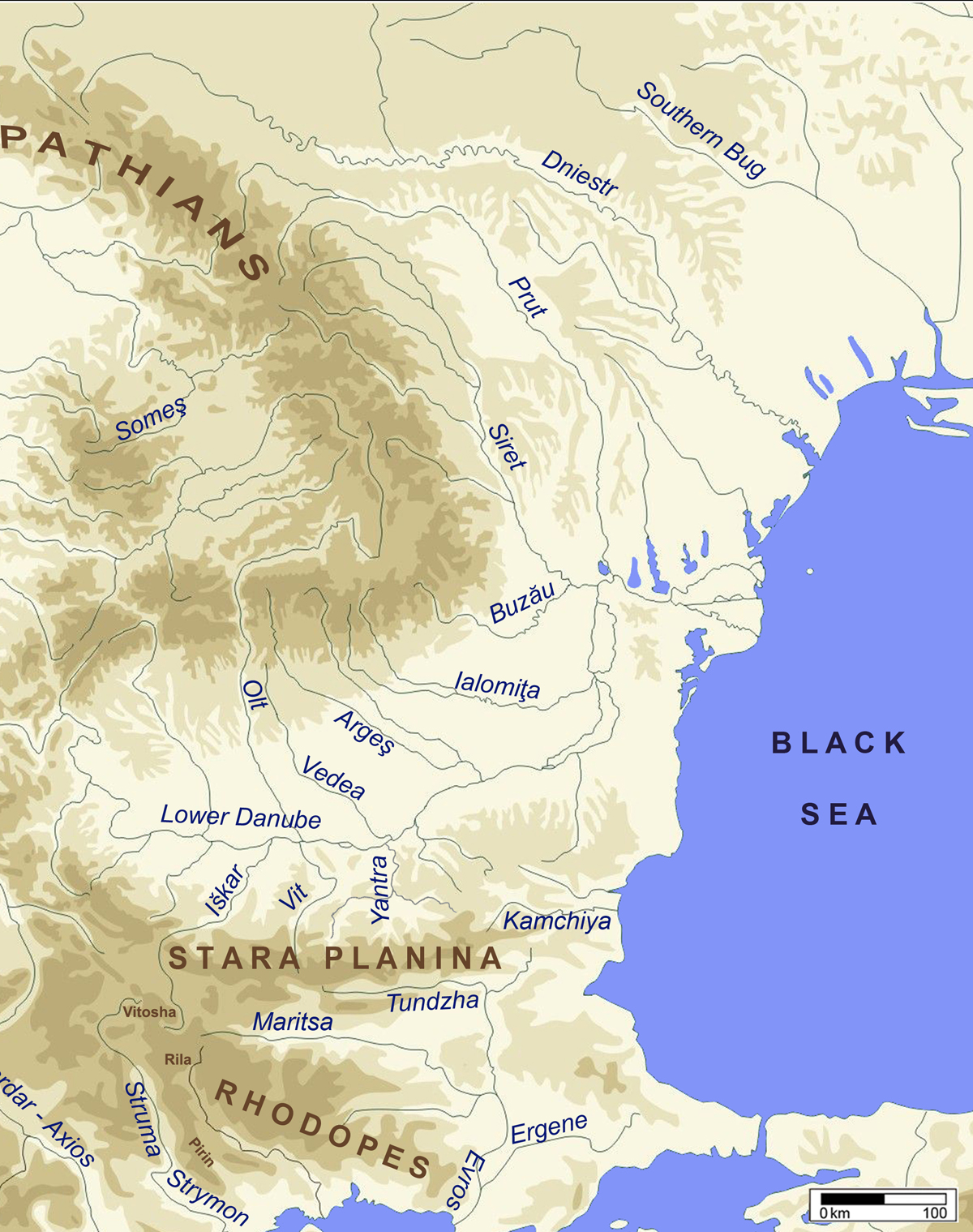
Figure 1. Map of eastern Balkans and the northwest and west Pontic region
 up
up