
 .................................................................................................................................................


Region III – Central Balkans
Geography
This region is largely defined by a series of north–south oriented mountain ridges and river valleys; the mountainous watershed continuing west of the Stara Planina is serving as the division between a southern and northern subregion (Figure 1).
IIIa. Central Balkans south:
In this subregion are included the catchments of the upper river valley of the Axios/Vardar and Strymon/Struma. The Strymon/Struma River originates directly west of the Vitosha massif that serves as a watershed towards the north. Here, the Basin of Sofia is connected by the river Iskar also with the Lower Danube area (Region IV). Culturally it is assignable to Region IIIa. Mount Vitosha, together with the Rila and Pirin Mountains define the eastern boundaries of Subregion IIIa towards Subregion IVa (Thrace).
IIIb. Central Balkans north:
In this subregion are included the Morava River and its tributaries.
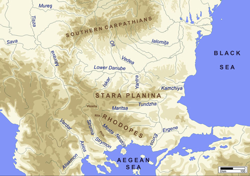
Figure 1. Geographical map of the central and eastern Balkans
Sites (n=30)
| IIIa: Central Balkans South | IIIb: Central Balkans North |
| Amzabegovo | Banja |
| Bălgarčevo | Blagotin-Poljna |
| Cerje-Govrlevo | Divostin |
| Čuka-Topolčani | Grivac-Barice |
| Djakovo (Kjustendil) | Pločnik |
| Dobrinišče | |
| Elešnica | |
| Gălăbnik | |
| Golema Tumba (Trn) | |
| Goljamata Peštera | |
| Grnčarica | |
| Kolarovo | |
| Kovačevo | |
| Kremenik (Sapareva Banja) | |
| Markovi Kuli | |
| Porodin | |
| Slatino (Čardako) | |
| Sofia-Slatina | |
| Strumsko | |
| Topolnica-Promachon | |
| Tumba near Bitola | |
| Tumba I near Mogila | |
| Tumba 4 near Porodin | |
| Veluška Tumba | |
| Vršnik-Tarinci |
 up
upGeography
This region is largely defined by a series of north–south oriented mountain ridges and river valleys; the mountainous watershed continuing west of the Stara Planina is serving as the division between a southern and northern subregion (Figure 1).
IIIa. Central Balkans south:
In this subregion are included the catchments of the upper river valley of the Axios/Vardar and Strymon/Struma. The Strymon/Struma River originates directly west of the Vitosha massif that serves as a watershed towards the north. Here, the Basin of Sofia is connected by the river Iskar also with the Lower Danube area (Region IV). Culturally it is assignable to Region IIIa. Mount Vitosha, together with the Rila and Pirin Mountains define the eastern boundaries of Subregion IIIa towards Subregion IVa (Thrace).
IIIb. Central Balkans north:
In this subregion are included the Morava River and its tributaries.
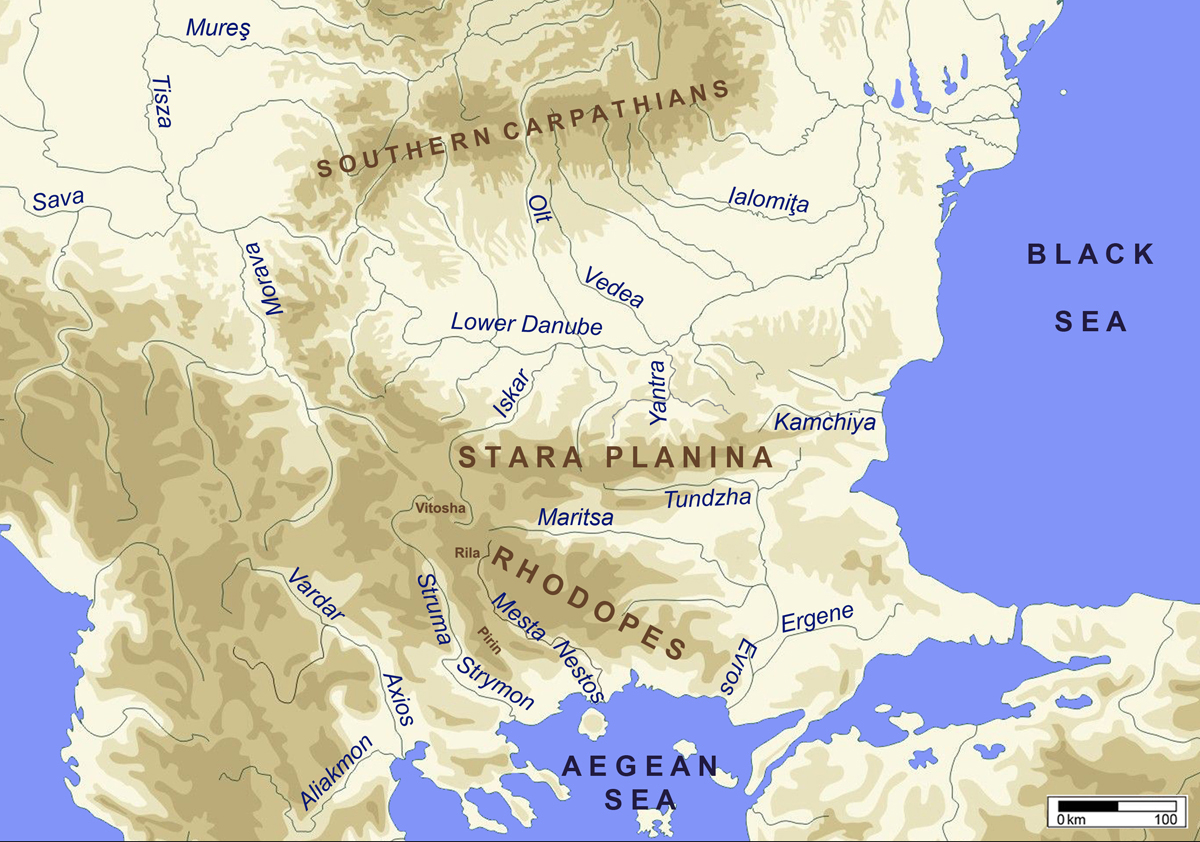
Figure 1. Geographical map of the central and eastern Balkans